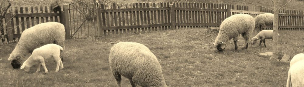
In 2006 I went home to Louisiana to visit family. The drive down culminated in my account of the damage wreaked the year before by Hurricane Rita, which was recounted in Remembering Rita. For a variety of reasons, almost all to do with Covid-19, I have been unable to travel south this year, so I am revisiting the 2006 trip, if not in body then in spirit. Grab yourself a cup of café au lait and a couple of beignets and come along for the ride.
Roadside attractions
April 18, 2006 (from my farm journals)
Forty minutes west of Jackson, Mississippi, and I’m pulling off in Vicksburg, a town so angry at the outcome of the War Between the States that its residents refused to celebrate July 4th until the 1950s. I’d love to have heard the debate among the city fathers when they had to choose, at the height of the Cold War, between endorsing the Union or being branded as Communists. It’s time for lunch, so I head to a favorite tamale stand, only to find it’s gone out of business after 40 years. I shake my head at the impermanence of life and settle for a bowl of dirty rice at Popeyes.
Back on I-20 I cross the bridge over the Mississippi, my plan being to head up to Poverty Point. A national historic site of earthen walls and mounds, it was built between 1750-1100 BC. Little is known of the advanced native civilization that did the building, but a huge amount of organization and energy were expended to create the settlement. And the fact that it was done during the Bronze Age makes it of even more interest. As I get closer to the site, I’m running late, so I leave the interstate on Route 577 at Waverly and travel on south. I know I am firmly back on native soil when 50 yards from the interstate lies a dead armadillo smack center of the road.
Driving alongside Bayou Macon, I watch as the land spreads out on my left, completely flat for miles on end. Few houses dot this almost-Midwestern landscape. I pass only a handful of cars and tractors before breezing through Warsaw, chiefly notable for one house, one church, and a roofless school whose remains of a sign reads “War— School.” Ten miles farther down the road is a small metal shack with no windows, four pickups outside, and a Miller beer sign on the front door. I’m four miles from the nearest house, many more from the next town, and I’ve discovered the local watering hole. I drive on.
My road runs out in Crowville, Zip code 71230. I turn onto Highway 17 and pass on through. Besides the post office, there is a hardware store, a feed-and-seed, and, improbably, an upholsterer. Crowville consists of well-maintained brick ranchers and seems prosperous, and the Midwestern feel continues. The towns in this area of Louisiana are compact. The streets end in cotton, soybean, or cornfields. The land is too useful for strip malls.
Another 15 miles and I hit Winnsboro and take a left onto Highway 15. Seat of Franklin Parish, Winnsboro has the air of importance that county and parish seats exhibit. An attractive Confederate memorial sits on the courthouse lawn, broad shade trees line streets with solid-looking homes, and azaleas the size of minibuses bloom in front yards. Outside the town stands a convention center–size building that houses a mega-church called the Water of Life. The congregation apparently espouses a brand of Christianity so neutered that the stained-glass door features not a cross but a river.
The road continues to Sicily Island in Catahoula Parish, a poor town of 500 for which the main sign of prosperity is one house with a new tin roof. Groups of kids hang out in the road dressed in hip-hop attire. They look sullen, free of any irony in adopting an urban culture when Vidalia, a town of 10,000, is an hour away. Such are the benefits of global culture. A building labeled “The Jail” in hand-painted letters — is this real or a joke? — lies at the single intersection. This is the unvarnished poverty of the end-of-the-road, no-hope variety.
On down the way is a gas station, no paved parking lot, just dirt all the way to the pumps. A sign is posted out front for lunch plates of crawfish and liver. I stop for second lunch. (Fortunately the choices advertised are not combined.)
Soon I pass the last cotton gin company, “Deer Creek, producer owned,” and I leave the Delta landscape behind.
The drive over a drawbridge at the Ouachita signals my arrival in the central-river parishes. Screened porches become the norm. I see a little of the north-central pine barrens appear and then as quickly vanish as the land becomes dominated by water. Small, neat fields of crops bordered by levees running in all directions contain the dozens of rivers, bayous, and creeks of this region. But seeing that glimpse of the pine forests that dominate in Winn, Caldwell, and the parishes farther north, I’m reminded of a favorite uncle, Al. He was riding through this area with my great-uncle Burl (husband of my great-aunt Ruby) on a business trip in the 1950s. After a day of driving among the endless rolling pine forests, Uncle Burl said, “This land is good for growing only two crops, pine trees and babies.”
Some of the latter are my kin, I reflect, as I arrive in Pineville for the night.
I’ll continue this trip next week. In the meantime, better find yourself a cold Dixie longneck, because it is only going to get hotter and muggier as we drive deeper south.
……………………………………………………………………..
Reading this weekend: Polybius: The histories. Book six, in this work, is the text that influenced the Founders in constructing our constitution.